|
Twin Falls Naturist Retreat is located in the Hastings Hinterland which is on about 150meters elevation - heading up the great dividing range and yet only around 65kms to the coast (Port Macquarie) - many people take extended nakations and use Twin Falls as a base.
We have national parks and many waterfalls / beautiful scenery to explore! There are also 4WD tracks for the more adventurous and many half or day trips await! (If you are planning a day out please remember to plan to leave here before 12pm and return after 1pm! (To avoid possible traffic conflicts on our road)) Exclusive is "Ask Mal" for additional information about some of these places... (just tap or click the Ask Mal notebook image!)
Twin Falls has no association with these places - they provided for information only. You should ascertain accessibility prior to visiting as access can be seasonal or limited after rain / gusty winds / fire, entry passes, closures, etc.
NB: Currently roadworks are in progress on the Oxley Highway in several places: If you are travelling from the West - Mt Seaview has road works. From the East - roadworks with stop and go before Long Flat, M1 South at Houston Mitchell Drive ... Last update : Sept, 2024
Apsley Falls - 110km (West) (Oxley Hwy)(20km past Tia Falls turn off) Early start recommended - lots of walks. click or tap to visit  See also - Oxley walking track, click or tap to visit Apsley Slate Walls lookout, click or tap to visit Rotary Lookout. See also - Oxley walking track, click or tap to visit Apsley Slate Walls lookout, click or tap to visit Rotary Lookout.
Bago Bluff via Rollover Road click or tap to visit See also - Bago Lookout via Blue Creek Road click or tap to visit
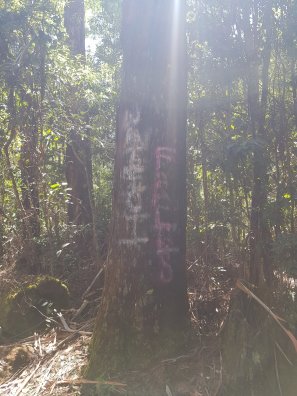
Bago Vineyards / Maze - 55km click or tap to visit See also - 200year old "Old Bottlebutt" Tall Tree off bago Rd click or tap to visit
Banda Banda National Park Waterfall (near Kempsey) click or tap to visit
Beechwood Hotel - 45km - click or tap to visit
Billabong Zoo - 50km - Oxley Hwy near donout (elevated roundabout M1 / Oxley Hwy) click or tap to visit
Biriwal Bulga National Park - Doyles River click or tap to visit
Blue Creek Dam - 48km - Gregge Rd, Bago click or tap to visit
Boorganna Nature Reserve - Rawson Falls (40m) click or tap to visit
Bridal Veil Falls - 34km via Byabarra / Bagnoo Rd (dirt) click or tap to visit
Byabarra Cafe & Bar click or tap to visit
Burrawan State Forest, Herons Creek click or tap to visit See also - Hello Koala click or tap to visit
Cassegrain Winery - 55km - Winery drive, off M1 heading north from "donut" (elevated roundabout M1 / Oxley Hwy) click or tap to visit
Coorabakh National Park - Lansdowne Area click or tap to visit
Comboyne Rock - (4WD Only) 48km via Byabarra click or tap to visit
Dorrigo National Park (elevated walk and 6km loop with several waterfalls) click or tap to visit See also - Dorrigo - Dangar Falls (turn right at the monument in the middle of the street in Dorrigo township - left walking track from lookout takes you down to the falls!) click or tap to visit
| Ellenborough Falls (200m single drop) - 70km (gravel road - AWD recommended when wet) click or tap to visit | |

|
Three ways to Ellenborough Falls (Before 10 am start!)
If you have a 4WD or AWD:
Option 1 - Toms Creek Road (dirt road - turn left off Blue Gum Lane) which will take you through farmland and up the side of the valley at the end. Great Views back over the valley. When you reach the top, turn left at the T Section (Innes View Road). Follow this until you reach the T section with Wingham Road where you turn Right. Turn Right onto Colling Road (dirt road 17 km), heading for the town of Elands. Just through Elands turn right onto Bulga Road, then right onto Ellenborough Falls Road (just before you cross the bridge).
Option 2 - Dry weather only.
If you are confident in your 4WD or AWD then you can try Blue Gum Lane - which turns into Ponsford Road (dirt road) max speed 20 km per hour. Great Scenery as you drive along the ridge of the valley. You will come to a T section with Wingham Road where you turn Right. Turn Right onto Colling Road (dirt road 17 km), heading for the town of Elands. Just through Elands turn right onto Bulga Road, then right onto Ellenborough Falls Rad (just before you cross the bridge)
All Vehicles
Option 3 Head out to the Oxley Highway and turn Right. Through Long Flat and then Right onto Bagnoo Road (dirt road 9 km). You come to the T section with Comboyne Road where you turn Right. Comboyne Road becomes Wingham Road as you pass through town. Turn Right onto Colling Road (dirt road 17 km), heading for the town of Elands. Just through Elands turn right onto Bulga Road, then right onto Ellenborough Falls Rad (just before you cross the bridge)
|
|
Long Flat - Travellers Rest (pub) and local shop (food!) click or tap to visit
Little Fish cafe and Restaurant - French inspired cuisine in the vineyard off ruins way, port macquarie click or tap to visit
Mt Jollynose / Queens Lake via Houston Mitchell Drive / Spring Creek Road (4X4 - Serious AT Tyres - sharp rock fragments) click or tap to visit
Mt Yarrahappini - M1 North - 100km. Great views at Yarriabini lookout via Warrell Creek (Gilnagay Road turn right Albert Drive, left Albert Drive at T, turn right under the railway - Rosewood Road to Tower Road) (AWD recommended - decent clearance needed for "forestry speed humps" click or tap to visit
Newbys Lookout - 100km - Coorabah NP Landsdowne click or tap to visit
North Brother Lookout - Camden Haven - 76km (North Haven) click or tap to visit
Old Logging Tramway - 53km (dirt road) Lorne Rd click or tap to visit
Punchbowl Falls - Brill Brill (Bellangry)(4X4) click or tap to visit
| Rawson Falls - 46km Innes View Rd (via Bagnoo Road or Toms Creek Road) click or tap to visit | |
|
Four ways to Rawson Falls
If you have a 4WD or AWD:
Option 1 - Toms Creek Road (dirt road) which will take you through farmland and up the side of the valley at the end. Great Views back over the valley. When you reach the top, turn left at the T Section (Innes View Road). Follow this for a while keeping an eye out for the Boorganna Access Trail. (On the right and on a corner). Follow the trail for a short distance to the car park.
Option 2 - Dry weather only.
If you are confident in your 4WD or possibly an AWD then you can try Blue Gum Lane via the creek crossing to the top ridge (after where you turn right at our TF sign to the first gate) which turns eventually into Ponsford Road (dirt road) max speed 20 km per hour. Great Scenery as you drive along the ridge of the valley. You will come to a T section with Wingham Road where you turn Right. Turn Right at Innes View Road and Left at Boorganna Access Trail (on a corner). Follow the trail for a short distance to the car park.
All Vehicles
Option 3 Head out to the Oxley Highway and turn Right. Through Long Flat and then Right onto Bagnoo Road (dirt road 9 km). You come to the T section with Comboyne Road where you turn Right. Comboyne Road becomes Wingham Road as you pass through town. Turn Right at Innes View Road and Left at Boorganna Access Trail (on a corner). Follow the trail for a short distance to the car park.
Option 4 No dirt roads.
Head out to the Oxley Highway and turn Right. Through Long Flat and then Right at Comboyne Road which becomes Wingham Road as you pass through town. Turn Right at Innes View Road and Left at Boorganna Access Trail (on a corner). Follow the trail for a short distance to the car park.
|
|
Ricardoes Tomatoes and Strawberry picking - 55km - Blackmans Pt (North of Port Macquarie - not during school holidays!) click or tap to visit
Shelley Beach / Sea Acres National Park - 70km - Sth Port Macquarie click or tap to visit
Tia Falls - 90km (7km of dirt Rd)(West) (Oxley Hwy) Early start recommended. Tracks do not go to the waterfall. 2km Tiara walk is often unused during weekdays (nude walk?!) click or tap to visit See also Apsley Falls.
Timbertown - 40km Oxley Hwy click or tap to visit
| Waitui Falls - 95km Kerewong (AWD / 4WD recommended) click or tap to visit | |
|
Waitui Falls (Before 10 am start!)
Head out to Oxley Highway, then follow it all the way to the Pacific Highway (alternatively turn right into Blackbutt Road at Wauchope, follow to end and turn right onto Cameron St, which becomes Bago Road, follow to you get to the M1 on-ramp to Taree) and head south along the Pacific Highway until and exit at Johns River Road. Turn Right onto Johns Rivers Road and turn Left at the roundabout with Stewarts River Road. Turn Right onto Hannam Vale Road. Hannam Vale Road will turn sharp right, continue straight onto Waitui Road. Waitui reach will become a dirt road and passes through a paddock. When you cross the wooden bridge keep an eye out for the tree, on the right, with the faint sign signifying you have reach Waitui Falls. You will see what looks like a wide dirt area on the side of the road on a bend (if no other cars are parked). The falls are only a short walk from the car. The bitumen roads can be worse than the dirt road. However, taken at a steady pace all vehicles should be able to reach Waitui Falls.
| 
|
|
Walcha township (for lunch? 20km from Appsley Falls) - 130km (West) (Oxley Hwy)
Werrikimbee NP - 106km via Forbes River Rd, (West) (Oxley Hwy)(4X4 or AWD) click or tap to visit
|
Willi Willi National Park (4X4 + UHF) click or tap to visit | |
|
Willi Willi Falls - Before 10 am start
4WD Only - preferably with UHF radio as you are meant to call your position every 2 kilometres once you reach Hastings Forrest Way.
You are heading for Beechwood, so head out to the Oxley Highway and turn Right, then around 29 kilometres turn Left onto Rosewood Road. After crossing the river turn Left onto Beechwood Road. Once you reach the Beechwood General Store (great steak sandwich with the works) turn Right onto Bellangry Road. The road will turn into a dirt road and you will be climbing a hill. At the top of the hill there is an intersection continue straight and the road becomes Hastings Forest Way (can be rough). Follow Hastings Forrest Way for about 20 kilometres until you reach Wilson River Road where you turn Right and wind your way down to the valley floor (keep an eye out for a glimpse of the falls as you descend). At the end of the road, you will have travelled as far as you can by car. You need to walk to the falls, provided the track is open. Check with the National Parks Web site before you head out.
Note the drive to the falls car park is interesting and scenic in itself. Take a picnic and have a dip in the river!
|
|
Wilson River Picnic Area - click or tap to visit
|
